Population
4,066,691
Stats SA source ↗
Visited · 20–21 October 2026
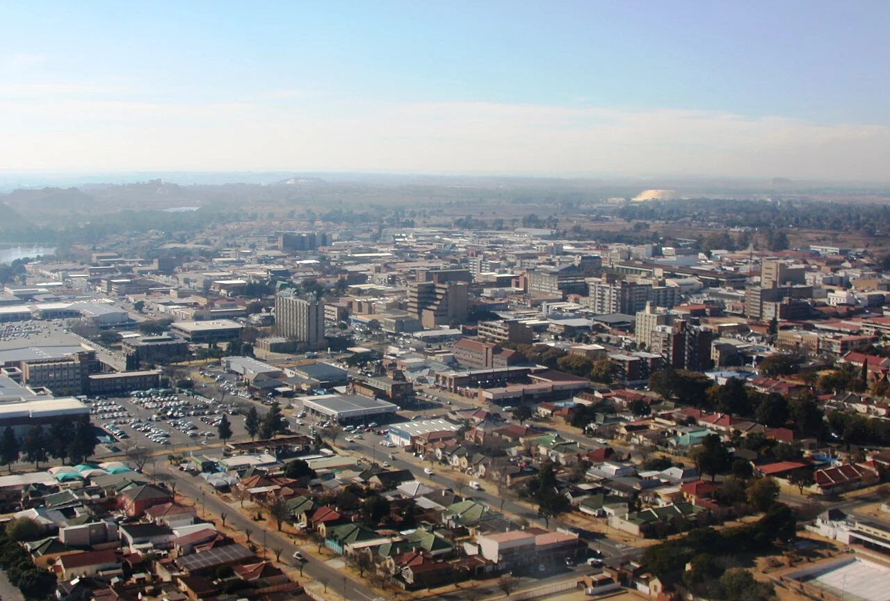
Benoni connects an East Rand gold-mining heritage with commerce, manufacturing, engineering and the services supporting the wider industrial economy.
Geographic boundary: Benoni town profile. Census 2022 figures cover the whole Ekurhuleni metropolitan area, not this town alone.
Published 2026-10-26 · Research updated 2026-10-26
Benoni’s role is broader than its gold-mining origins. The City of Ekurhuleni’s IDP identifies Benoni’s CBD as a concentration of finance and local retail, within a metropolitan economy with substantial manufacturing and transport activity. Nearby Dunswart forms part of the metro’s industrial geography. The report therefore treats commerce and industrial services as present-day drivers and gold as historical and regional context.
Metropolitan sector totals are not Benoni-only output or employment figures. Metalworking and industrial supply do not establish a locally mined ore body, and mining heritage is not evidence that a particular shaft is currently operating.
Assess industrial material recovery, workshop and manufacturing waste streams, water efficiency and supply-chain opportunities. Evaluate legacy mining land separately through site records and authorised assessment.
Embo Sotho Resources’ development interpretation; opportunities require project-specific assessment.
Integrated Development Plan 2024/25 — economic structure and geography ↗
City of Ekurhuleni / National Treasury
Read with the dated operational and census references below. Regional resource descriptions are not reserve estimates or a register of all currently operating mines.
Benoni · Sources retain their original period and geographic boundary. Compare municipal context →
Whole municipal area, not the town. Source report PDF pages 8 and 30.
4,066,691
Stats SA source ↗91.2%
Stats SA source ↗89.4%
Stats SA source ↗94.1%
Stats SA source ↗93.1%
Stats SA source ↗The second-generation Highveld air-quality plan, gazetted in March 2025, includes Ekurhuleni in its regional hotspot context. This is historical and regional evidence, not a measured concentration for the October visit.
DFFE · Gazetted 26 March 2025; includes historical studiesGovernance: the AGSA 2024/25 report series was checked. No individual municipal audit opinion is assigned here without a verified municipal audit record.
Statistics South Africa · Census 2022; publication 2023, revised edition · Municipality; 2021-aligned boundaries · Accessed 26 October 2026
Stats SA is the original source. Table selection and presentation are Embo Sotho Resources’ independent processing. Municipal averages are not town measurements. Piped water on site includes inside the dwelling and in the yard.
DFFE · Gazetted 26 March 2025; includes historical studies · Highveld Priority Area · Accessed 26 October 2026
Regional policy and historical modelling context, not a current station reading or a causal assessment of one operator.
These independently maintained notes may pre-date the research edition above. Their own review date applies.
Benoni’s role is broader than its gold-mining origins. The City of Ekurhuleni’s IDP identifies Benoni’s CBD as a concentration of finance and local retail, within a metropolitan economy with substantial manufacturing and transport activity. Nearby Dunswart forms part of the metro’s industrial geography. The report therefore treats commerce and industrial services as present-day drivers and gold as historical and regional context.
Industrial resource use and the wider East Rand’s mining legacy make water, dust, safe land management and traceable material handling priorities for assessment.
Census 2022 provides a metropolitan demographic and service-access baseline. It is presented separately from town conditions.
The City of Ekurhuleni’s adopted IDP provides the planning and economic context. Project delivery and individual site compliance require their own records.
Assess industrial material recovery, workshop and manufacturing waste streams, water efficiency and supply-chain opportunities. Evaluate legacy mining land separately through site records and authorised assessment.
Potential areas for assessment; these are not funded or approved projects.
Discuss a local opportunity →Field visit: 20–21 October 2026. Research edition published 26 October 2026. Supporting documents retain their own reporting periods.
Not yet established
Town · Period not established
A dated, geographically appropriate source and measurement method are still required.
Not yet established
Town · Period not established
A dated, geographically appropriate source and measurement method are still required.
Not yet established
Town · Period not established
A dated, geographically appropriate source and measurement method are still required.
Not yet established
Town · Period not established
A dated, geographically appropriate source and measurement method are still required.
Not yet established
Town · Period not established
A dated, geographically appropriate source and measurement method are still required.
Environmental & Waste Management directorate listed
Local municipality · Undated administrative page
Document availability or administrative structure only; not an assessment of performance.
Source 1City of Ekurhuleni · 2024/25 · Local municipality
Metropolitan economic context, not town-level sector shares.
Accessed 2026-10-26
Send a correction or a source with its date and geographic coverage. Community accounts are reviewed separately from measured or official findings. Please avoid sending personal or sensitive details.
Suggest a correction →